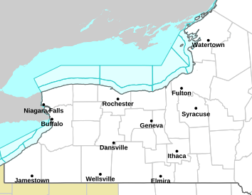
Severe Thunderstorm WARNING in effect for Lewis and Jefferson Counties
FOR LEWIS AND JEFFERSON COUNTIES......A SEVERE THUNDERSTORM WARNING REMAINS IN EFFECT UNTIL 200 PM EDT FOR JEFFERSON...LEWIS AND NORTHEASTERN OSWEGO COUNTIES... At 129 PM EDT, a severe thunderstorm was located over Glen Park, or near Watertown, moving southeast at 50 mph. THIS IS A DESTRUCTIVE STORM FOR Watertown and northern Jefferson county. HAZARD...80 mph wind gusts and quarter size hail. SOURCE...Law enforcement. IMPACT...Flying debris will be dangerous to those caught without shelter. Mobile homes will be heavily damaged. Expect considerable damage to roofs, windows, and vehicles. Extensive tree damage and power outages are likely. Locations impacted include... Watertown, Fort Drum, Stony Point, Carthage, Lowville, West Carthage, Clayton, Adams, Dexter, and Redfield. This includes Interstate 81 between exits 37 and 52. PRECAUTIONARY/PREPAREDNESS ACTIONS... For your protection move to an interior room on the lowest floor of a building. This is a DANGEROUS SITUATION. This storm is producing widespread wind damage across northern Jefferson county. SEEK SHELTER NOW inside a sturdy structure and stay away from windows. Torrential rainfall is occurring with this storm, and may lead to flash flooding. Do not drive your vehicle through flooded roadways.
undefined
KEEP AN EYE ON TH SKY, THIS IS A DANGEROUS STORM!!!